The Taking of Pearson: 1942
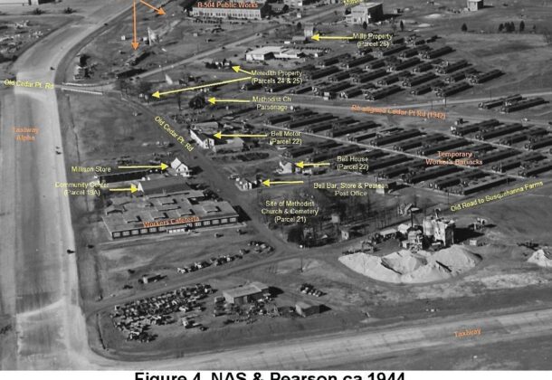
NAS and Pearson circa 1944
US Navy Photograph; Annotated by Mike Smoleck
St. Mary’s County Historical Society has published Chronicles of St. Mary’s since 1953, an unrivaled trove of diligent local historians’ work, eclectic in subject and style. The Historical Society presents excerpts from a few as an invitation to explore more of our history, the shared and the unknown. A digitized record of the Chronicles is available through the member’s portal on the website and on-site research is available to all.
By Peter Himmelheber of the St. Mary’s County Historical Society; excerpt from Chronicles of St. Mary’s, Winter 2019. These excerpts have been edited by the publisher.
In 1942 the United States Government, by its right of Eminent Domain, confiscated a large area of the Eighth District of St. Mary’s County, Maryland to be used by the United States Navy as a test facility for aircraft. The government bought 6,412 acres for $712,287 consisting of 113 land tracts and home to 230 families. This paper investigates only a small portion of these tracts in an area known as PEARSON.
WHERE WAS IT?
An 1892 U.S. Geological Survey map shows a building with what appears to be a church symbol. Also shown are a cluster of two buildings on the Patuxent River shore in an area labeled Millstone. A 1905 map of the area showing a cluster of nine buildings along the road from Jarboesville to Cedar Point. But Pearson is shown labeled a little over a half mile north of these buildings.
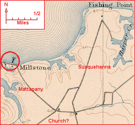
Pearson Area 1892
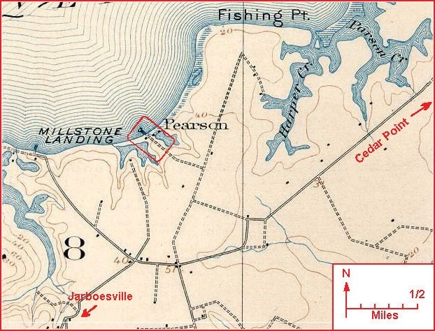
Pearson Area 1905
Regina Combs Hammett in “History of St. Mary’s County Maryland 1634-1990” cites “Pearson” as possessing a Post Office from 1901-1946; a “downtown” described as “a cluster of buildings” in 1942, and in 1898 C.H. Pearson operated an Oyster & Fruit packing business.
WHO WAS C.H. PEARSON?
Charles H. Pearson appears in a deed dated January 12, 1898 for “all those several tracts, pieces or parcels…in the eighth district … commonly called and known as Susquehannah containing six hundred and ninety seven acres …” Later that month, the 26th, Charles H. Pearson, of Baltimore, Md. buys the Right Title & Interest of “Carroll Banks, being a portion of Susquehanna Farm …”, red rectangle in the 1905 map above, and a complete Packing plant “… belonging to said farm.” …
The 1900 census lists Charles H. Pearson, age 40, a widowed farmer, boarding in the dwelling of Mattie A. Graves, in the eighth election district, St. Mary’s Co. On July 9, 1904, Charles H. Pearson, of Baltimore, Md. sold Susquehanna to Frank J. Caughy.
Charles H. Pearson appears in the census of 1910 and 1920 as an Insurance Agent/Solicitor living in Baltimore, Md. The November 11, 1922 issue of The Enterprise published the following:
“Pearson, Charles H. – Died suddenly on Thursday last [November 9, 1922]. He was the former owner of Susquehanah farm, in the 8th district, and a widely known broker and insurance agent, of Baltimore.”
THE TAKING
The Confiscation of 1942 produced a map of the entire area with all of the tracts affected. No buildings were shown but the suspected Pearson “cluster,” author annotations in red, is show below.
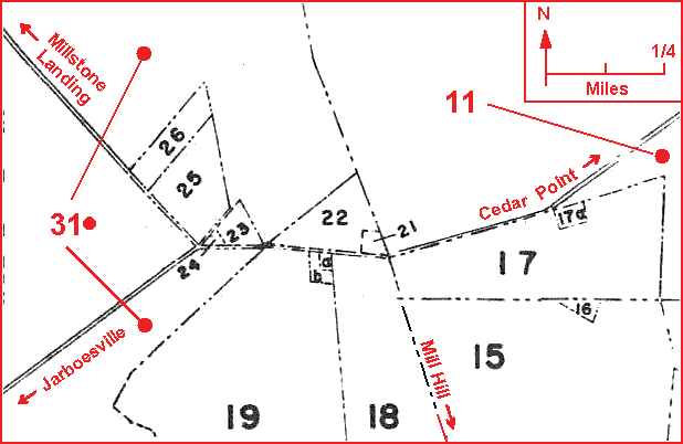
Each of these numbered tracts were defined by a possessor & St. Mary’s County land records as follows:
-
-
- 11. Samuel D. Young
- 15. Ernest & Marnette Fish
- 17. E. Irving, Archie E. & Eleanor Bell
- 18. R.T. Hammett
- 19. W.C. Pebroke
- 19a. Cedar Point Rural Women’s Club
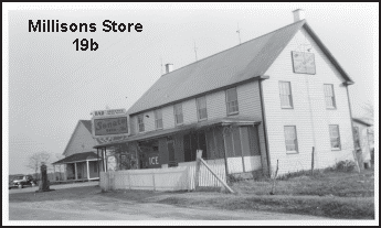
- 19b. Hiram Millison
- 21. Methodist Episcopal Church Trustees
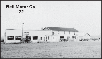
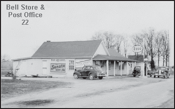
- 22. J.E. Bell
- 23. M.E. Church Parsonage
- 24. Mary E. Meridith
- 25. Mary E. Meredith
- 26. Robert C. & Edith M. Miles
- 31. George & Theresa Weschler
-
I went through each of the land references of the above table and found ZERO mentions of Pearson. I did find calls to “Loretta, House Field, Twin Holly Field, Freeman’s Land, Forrest Land, Millison’s Store, road Millstone to Cedar Point and Mill Hill, Lakeland, Three Gates, Mattapony, and Susquehanna” just to mention some.
The 1944 photograph (at top of post was) taken by the Navy of what are Pearson buildings, annotated in Yellow and NAS buildings, annotated in Orange; annotation by Mike Smoleck and staff.
The following pictures are of some of the Pearson buildings which were taken bef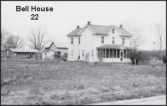 ore they were demolished. Annotations are mine:
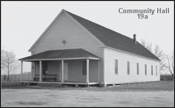
More of the story is available in The Chronicles available through St. Mary’s County Historical Society, which curates a repository of a unique collection of Maryland memorabilia and museum pieces displayed on the first 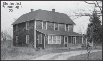 floor of Tudor Hall and in the Old Jail Museum located at 41625 Courthouse Drive in historic Leonardtown. The 18th-century Tudor Hall also serves as headquarters of the society and houses the Historical Society’s Research Center.
While much of the property and programming remains shuttered during the COVID-19 pandemic, much of the materials available through the Historical Society are digitized and accessible. To learn more visit the website linked above.
To find more posts by the St. Mary’s Historical Society, visit this Leader member page.