New FEMA Coastal Flood Maps Ready for Review
Leonardtown, MD –The Federal Emergency Management Agency (FEMA) has released updates to the coastal flood maps, known as Flood Insurance Rate Maps (FIRMs), for St. Mary’s County.
Jay Duke of Waring Ahearn Insurance urges homeowners to become familiar with these maps. If your home is in the newly mapped flood plain boundaries and does not currently carry a flood insurance policy, he urges you to speak with a qualified flood insurance agent as soon as possible. The new maps indicate heightened flood risk in previously identified flood plains and show an extension of the flood plain boundaries. The resulting changes that will occur with flood insurance will have a substantial impact on new policy premiums, Mr. Duke said.
These updates are to be preliminarily issued to St. Mary’s County June 9, 2014. The FIRMs indicate flood-prone coastal areas in St. Mary’s County, and insurance companies use FIRMs to determine flood insurance rates for buildings and contents. St. Mary’s County residents and property owners are encouraged to learn more about their flood risk and the updates shown on the preliminary maps, reads the county government press release announcing the open house where the new maps will be displayed and discussed.
St. Mary’s County will hold a public Coastal Flood Risk Open House on the updates at Dr. James A. Forrest Career and Technology Center 24005 Point Lookout Rd, Leonardtown, MD 20650, June 9, from 6 – 8:30 pm.
Using interactive flood maps at this Open House, representatives from the State, County, Town of Leonardtown, along with FEMA and their mapping partners, will be available to answer flood risk and insurance questions and explain the preliminary maps.
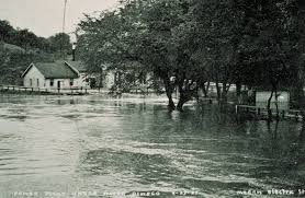
Flooding is the number one natural disaster in the United States. It is vital for property owners to understand their risk and take advantage of tools and programs available to them, including flood insurance, to help reduce flooding impacts.
The preliminary maps to be shared at the Open House are an update of the existing FIRM, which dates back to October 2004. These preliminary FIRMs and the associated Flood Insurance Study (FIS) provide the basis for flood risk education and floodplain management measures. St. Mary’s County is required to adopt updated maps to continue participating in the National Flood Insurance Program (NFIP), which makes flood insurance available to the community.
As a result of these map updates, some buildings in St. Mary’s County may, for the first time, be included in a high-risk flood zone, known as the Special Flood Hazard Area, or SFHA. This may result in mandatory purchase of flood insurance for those affected property owners. FEMA staff will be at the Open House and available to speak with property owners about these updates and what it means to them.
Additional information, including links to the interactive mapping website, can be found at www.R3Coastal.com or by contacting one of the Environmental Planners in the Department of Land Use and Growth Management at 301-475-4200, ext. 1500.