Amber Drive Transforming into FDR Boulevard
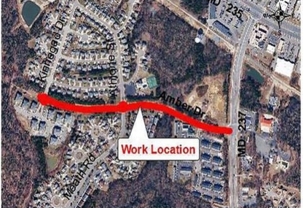
For the next year or so, residents of Hickory Hills subdivision will share the single access road into their subdivision with construction vehicles on a mission to transform the .5-mile Amber Drive into another segment of FDR Boulevard. Crews will be working from 7 am to 5 pm weekdays and 8 am to 5 pm weekends.
Amber Drive to be reconstructed and changed to FDR Boulevard
FDR Boulevard is designed for lower traffic speeds and to accommodate pedestrians and bicycles since its full scope traverses large residential developments such as Laurel Glen, Hickory Hills, and San Souci, according to the newly adopted Lexington Park Master Plan.
The plan ranks FDR Boulevard as St. Mary’s County government’s top transportation priority to “increase access between primary destinations … Other streets in this priority provide important connections between existing neighborhoods and commercial areas.”
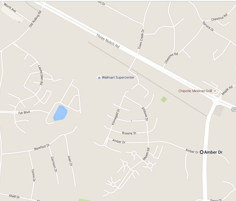
This particular segment of FDR Boulevard into Hickory Hills will not make additional connections. Amber Drive extends west off Chancellors Run Road and forms the trunk of branches of mostly dead-end roads comprising the Hickory Hills subdivision. Amber Drive and the subdivision itself extends to Kinnegad Drive which runs north. Kinnegad stops less than 100 feet short of Taylor Lane where a connection could provide the sprawling Hickory Hills subdivision with a second access.
During the years the St. Mary’s County Planning Commission wrote the Lexington Park Master Plan, the need for road connections and multiple access into and around the area’s subdivisions grew beyond the need for better traffic movement and best land usage and into safety and health concerns.
Traditionally, St. Mary’s County has not required new developments connect with their neighbors, not even when they are physically right next door. Thus, no grid system ever developed. Instead it became that there is only one route to each place. A case in point being the bridge between St. Mary’s and Calvert counties. Another example, a highway accident when there simply isn’t a detour. It’s as if, being a peninsula, we came to develop like a peninsula. One way in. Same way out.
The results are sprawling subdivisions with a single access point, a logistical problem in most emergency situations and ultimately susceptible to increased crime. Traffic, the presence of others, is a significant crime deterrent. In particular, in Lexington Park, where cul-de-sac style communities abut woodlands, law enforcement has a particularly difficult time maintaining effective and routine patrols.
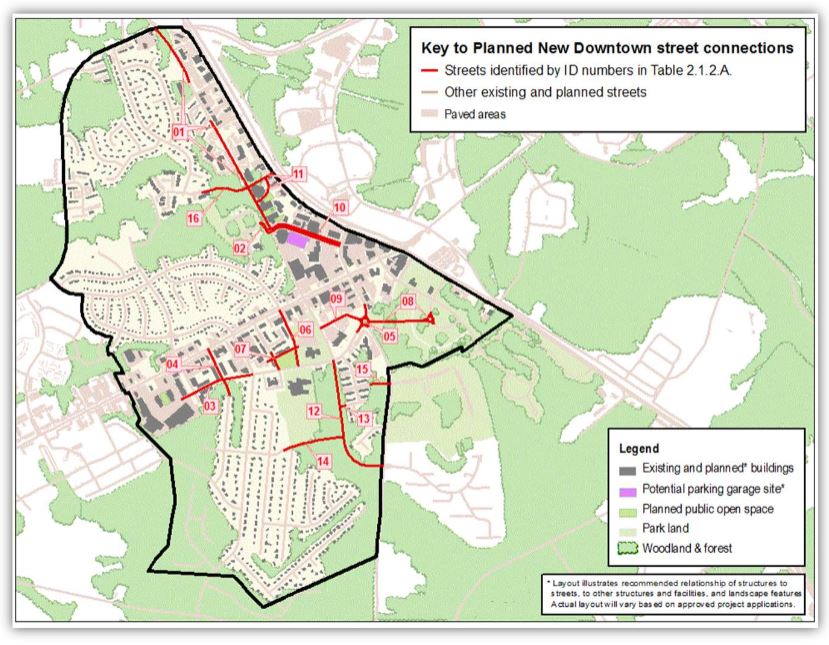
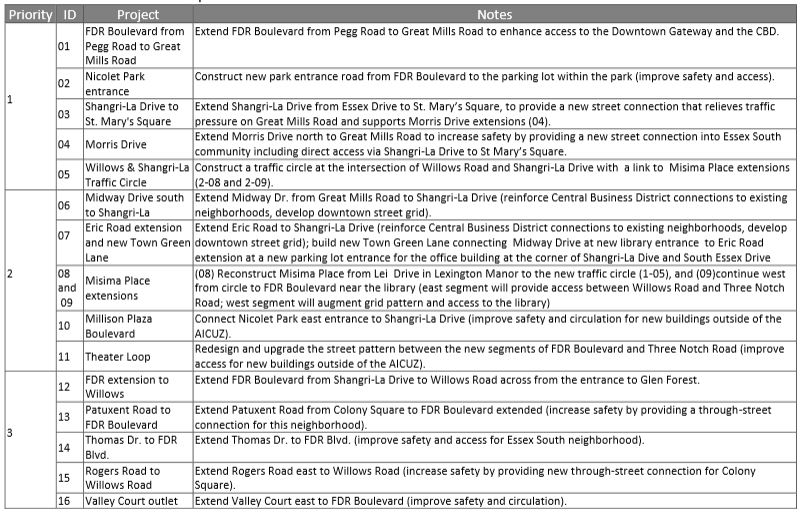
“The growth of Downtown will require redevelopment, an improved transportation network of Complete Streets,” reads the Lexington Park Master Plan which proposes 16 new street connections in downtown Lexington Park.
Lexington Park news is SPONSORED BY